Python/API
The OpenWeatherMap is a wonderful app that allows you to pull current and historical weather data from locations all over the world. For instance, if you wanted to know which geological factor had the greatest impact and correlation to temperature in any city around the world you could quickly find the answer with the use of Python, Numpy, Pandas, and Requests.
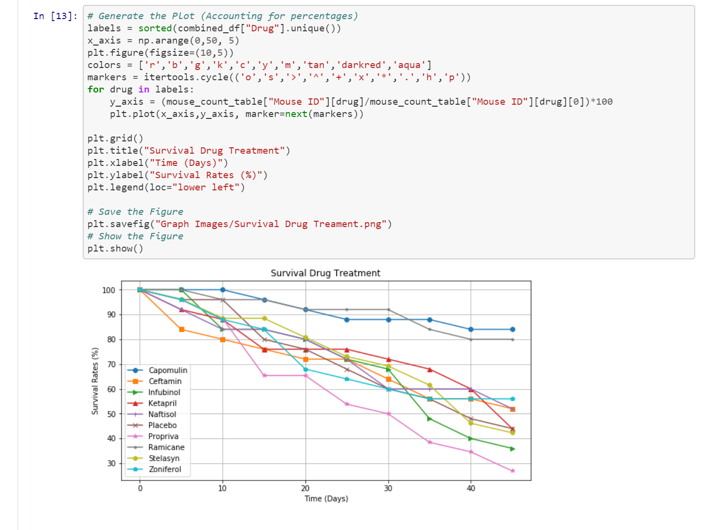
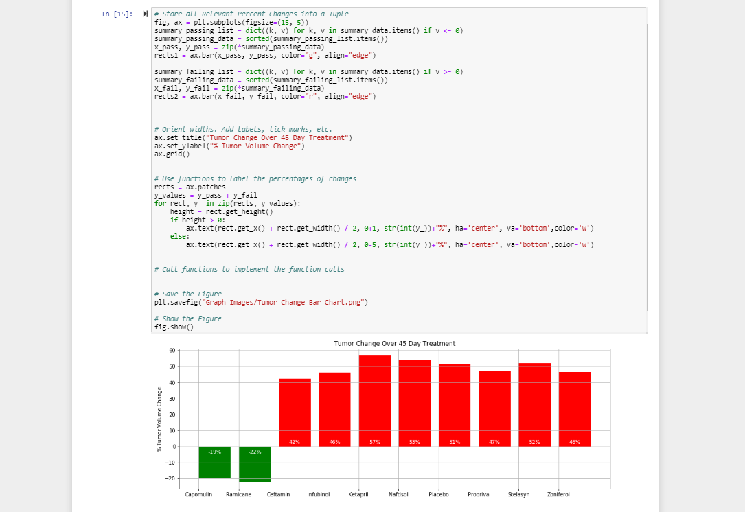
A random selection of 500-600 cities were chosen and data gathered regarding their max temperature, cloudiness, humidity, wind speed, and latitude. The temperature data was then compared to these other four factors and plotted to find if any correlation could be found. It was quickly evident that the only factor showing correlation was latitude.
This data and the associated graphs were used in the HTML/CSS project. You can learn more about the HTML/CSS project here.
Please click here to view the Jupyter Notebook on GitHub.